
ILS – Incident Light Sensor
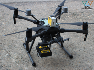
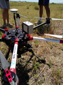
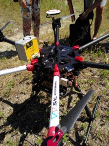
The Incident Light Sensor integrated with MAIA multispectral camera measures the level of the ambient light for each shot in each band during multispectral survey. It allows the correction for downwelling light changes during the flight, such as those caused by clouds covering, and calculate the true reflectance ratios for the correct index calculations.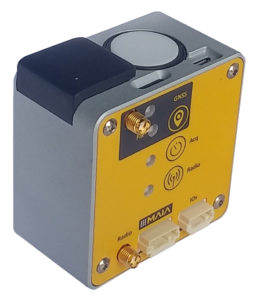
Furthermore, the ILS features a 6-axis inertial unit for motion processing, an environmental sensor for pressure, temperature and humidity measurement and a GNSS receiver with an embedded antenna that provides timestamp and position information for accurate geotagging of each image acquired by MAIA.
The ILS connects directly to MAIA multispectral camera and is powered and controlled by it, without any specific action required by the user for its operation, once properly mounted on board.
All parameters measured by ILS are automatically stored into the log file related to the image acquisition set, and are available for pre-processing with MultiCam Stitcher Pro, the MAIA images pre-processing software.
A high precision GNSS version with RTK is available, which allows a centimeter-level positioning accuracy. In this case, an additional ILS which acts as base station is necessary for proper operations.
ILS 1 990 € VAT excl.
ILS RTK 2 560 € VAT excl.
RTK BASE 1 820 € VAT excl.
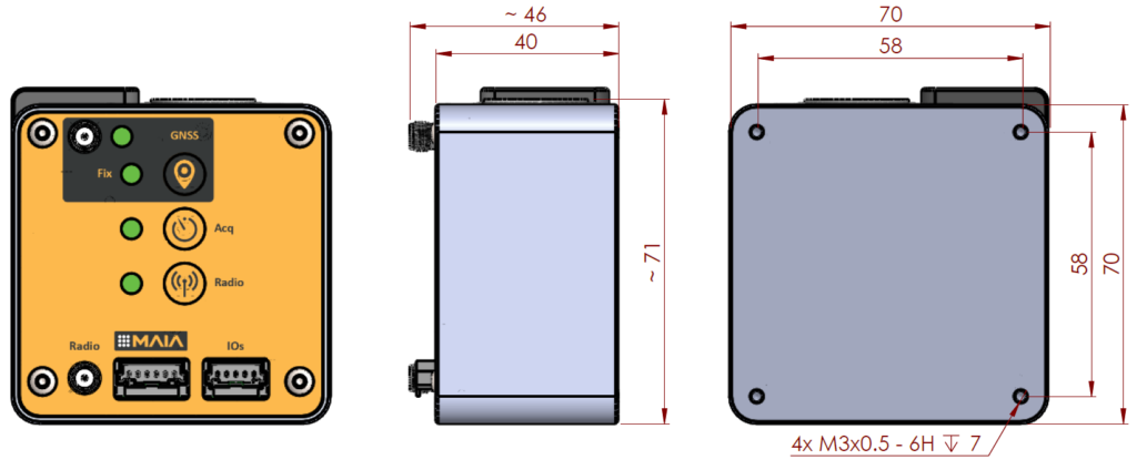
Frame
- Size: 70 mm x 70 mm x 40 mm (excluding connectors)
- Weight: 160 g
Power supply
- Powered by MAIA itself (recommended);
- powered by a 4.5 – 9 VDC / 600 mA supply.
Irradiance sensor
- True cosine correction of incident light;
- accurate irradiance measurement thanks to patented technology;
- incident light level measured for each band of MAIA multispectral camera, with matched spectra depending on the filter-set installed;
- two versions of ILS – Incident Light Sensor correlated to filter-set settled in MAIA: ILS WV and ILS S2
| Band | Start WL (nm) | Stop WL (nm) | CWL (nm) | Colour |
| 1 | 395 | 450 | 422.5 | Coastal |
| 2 | 455 | 520 | 487.5 | Blue |
| 3 | 525 | 575 | 550 | Green |
| 4 | 580 | 625 | 602.5 | Orange |
| 5 | 630 | 690 | 660 | Red |
| 6 | 705 | 745 | 725 | Red Edge |
| 7 | 750 | 820 | 785 | NIR 1 |
| 8 | 825 | 950 | 887.5 | NIR 2 |
Summary of optical bands detected by ILS WV related to MAIA WV multispectral camera.
Download ILS WV – Incident Light Sensor Datasheet
| Band | Start WL (nm) | Stop WL (nm) | CWL (nm) | Colour |
| 1 | 433 | 453 | 443 | Violet |
| 2 | 457.5 | 522.5 | 490 | Blue |
| 3 | 542.5 | 577.5 | 560 | Green |
| 4 | 650 | 680 | 665 | Red |
| 5 | 697.5 | 712.5 | 705 | Red Edge 1 |
| 6 | 732.5 | 747.5 | 740 | Red Edge 2 |
| 7 | 773 | 793 | 783 | NIR 1 |
| 8 | 784.5 | 899.5 | 842 | NIR 2 |
| 9 | 855 | 875 | 865 | NIR 3 |
Summary of optical bands detected by ILS S2 related to MAIA S2 multispectral camera.
Download ILS S2 – Incident Light Sensor Datasheet
6-axis IMU (Invensense ICM-20689)
- 3-axis gyro with +/- 250 deg/s full-scale-range and 0.1 deg/s resolution;
- 3-axis accelerometer with +/-4 g full-scale-range, and pitch and roll angles with 0.1 g resolution.
Environmental sensor (Bosch BME280)
- 0-60 ºC temperature measurement range, ±1 ºC accuracy (*);
- 800-1100 mbar pressure measurement range, +/-1 mbar accuracy;
- 0-100% RH humidity measurement range, +/-5% RH accuracy.
(*) The thermometer measures the temperature inside the ILS case, which is, in general, higher than the ambient temperature due to several external factors, including the heating caused by the solar radiation and the dissipation feature of the mounting fixture.
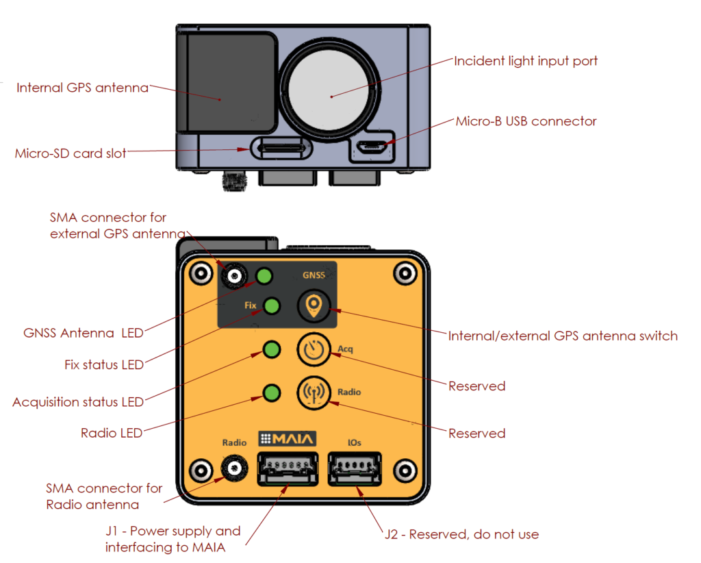
GNSS receiver
- Standard precision receiver or high precision RTK for centimeter-level positioning accuracy;
- concurrent reception of up to 3 GNSS (among GPS, Galileo, GLONASS, BeiDou);
- navigation sensitivity of -165 dBm;
- better and faster positioning, supporting all satellite augmentation systems;
- integrated passive antenna;
- SMA connector supporting active or passive external antenna.
Key features
- Irradiance levels of light measured with bands matched with MAIA multispectral camera;
- GNSS receiver with onboard antenna, supporting the use of an external active or passive antenna;
- 6-axis IMU and pressure, temperature, humidity sensors;
- seamless connection to the MAIA multispectral camera;
- data of each measured parameter are included in the camera log file;
- single-cable connection to MAIA multispectral camera for power supply and control;
- 1s measurement rate of all parameters, synchronized with the image acquisition;
- micro SD card for additional log files storage (8 GB bundled);
- USB interface to access the SD from the host computer without removing the SD.
MAIA WV and MAIA S2 can be equipped with the Incident Light Sensor – ILS for the radiometric correction of each single shot in each single band, for the best multispectral data acquisition:
- determine precisely the fertilization by identifying the symptoms of nutritional deficiencies;
- optimize the contribution of pesticides through the early identification of biotic stress;
- optimize irrigation of crops by identifying areas of potential water stress;
- calculate agronomic indices, and set a monitoring plan in order to preview the yield;
- monitor dumps, rivers, sea water, soils, mines and forests with a correct radiometric information, to create an effective monitoring plan of interventions.
Strenghts
-
Pixel-level geo-referenced and radiometric corrected images without ground targets for GCP or radiometric correction (very time-consuming task).
-
Possibility to conduct multi-temporal surveys on the same crop, to enhance differences in vegetation health status or in pollutant detection.
-
MAIA WV and MAIA S2, equipped with the Incident Light Sensor, give you the ability to get the correct data for the best knowledge of the crop, so you can make the right decisions at the right time.
-
True reflectance measurement under any light condition for each bands, independently.
-
Integrated cm-level GNSS positioning with Real Time Kinematics (L1 – RTK).
-
Possibility to build wireless network of base stations for wide area coverage.