
MAIA WV, MAIA S2 and ILS
The proper instruments for your multispectral survey
SAL Engineering designs and produces integrated systems for aerophotogrammetric and terrestrial surveys for 3D reconstruction with high accuracy of terrains, farms, buildings, factories, mines, landfills, construction sites, radio towers, bridges, roads and rails infrastructures, historical buildings. A flexible and non-invasive procedure permits a wide range of applications in data acquisition.
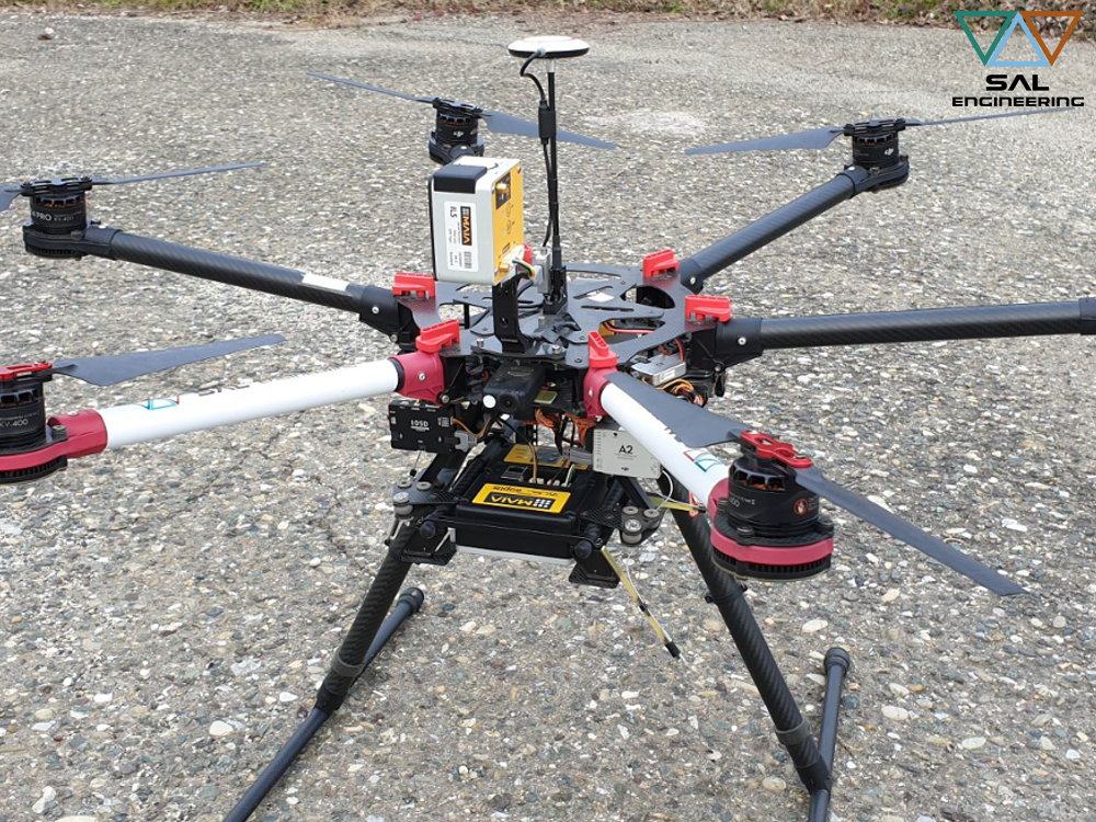
The system is composed by a remotely operated aerial vehicle, a gimbal for stabilized shooting, and the multispectral, thermographic or photogrammetric sensor. The integration of inertial platform and GNSS allows a stabilized and planned flight through waypoints; other GNSS antenna and receiver allow the georeferencing of each photo, for a better and faster 3D reconstruction in Structure from Motion softwares. In fact, multiband frames and GNSS data are elaborated with more developed photogrammetric softwares, that use Sfm and Bundle Adjustment algorithms for the creation of an high density point cloud (with RGB data), with which it is possible to create different products.
The acquisition of georeferenced photos is complementary to a topographic survey on field; different GCPs (Ground Control Point), that are visible on photographs, are measured by GNSS system or Total Station with high accuracy, due to optimize the bundle adjustment process, georeference the 3D model and insert it in a geodetic reference system. If a portion of the area is not suitable for photogrammetric survey, a topographic survey is done and data are lately integrated in the point cloud due to produce a complete model of the entire area.
SAL Engineering presents MAIA, the multispectral camera that provides simultaneous acquisition of high-resolution images at different wavelengths in the visual (VIS) and near infrared (NIR) regions. It is designed to be used onboard remotely piloted aircraft systems or aircraft, as well as having several terrestrial uses.
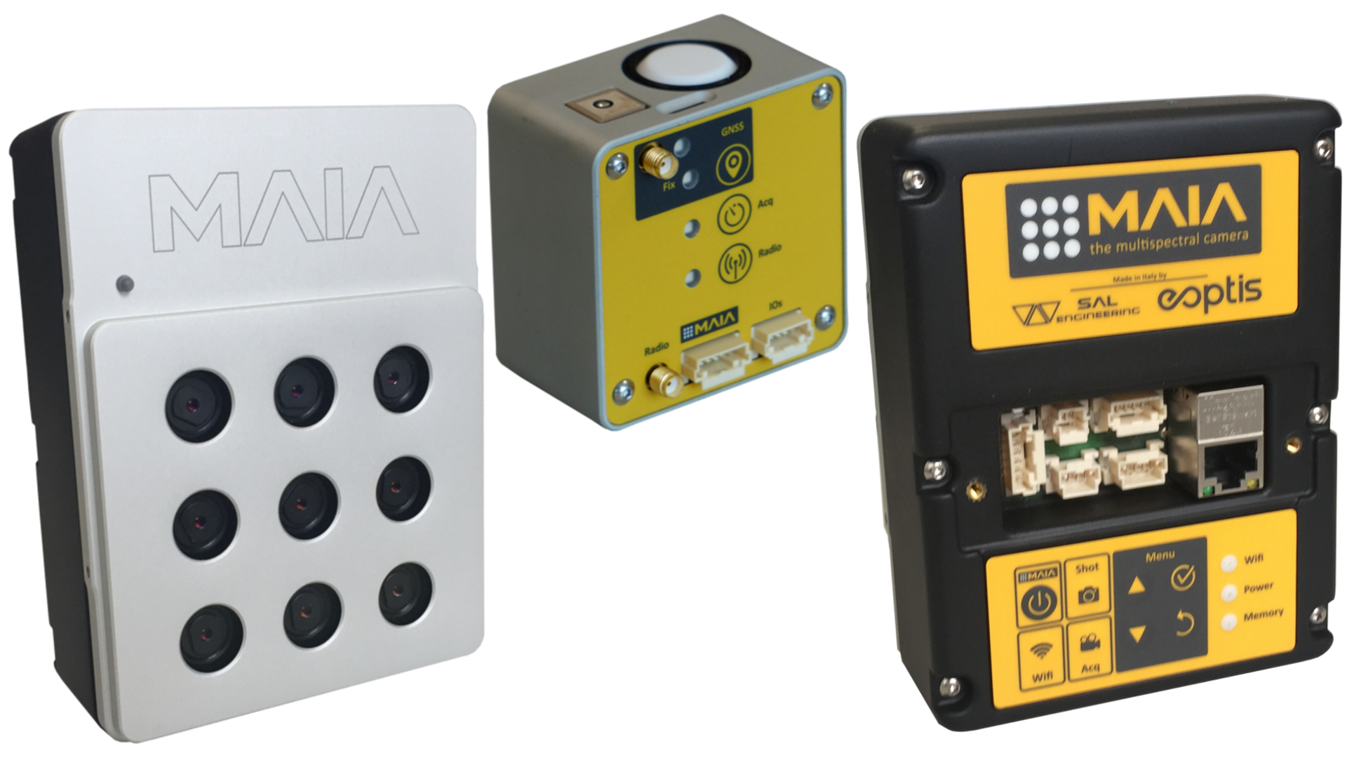
MAIA Multispectral Camera is based on an array of nine sensors, each with its relevant band-pass filter that precisely defines the radiation range to be detected. The sensitivity interval of the MAIA WV model is from 390 nm to 950 nm, while the MAIA S2 model has the same wavelenght intervals of Sentinel-2 satellite, and then it goes from 433 nm to 875 nm, which allows the camera to be used for several applications in agricultural, industrial and environmental monitoring. In fact, two filter sets are offered by default, matching the bands of the WorldView-2™ or Sentinel-2™ satellites. Other filters within the sensitivity interval can be supplied on request, depending on the customer needs.
The sensors have 1.2 Mpixel resolution, which generates a total resolution of 10.8 Mpixel per shot, separated into the various bands. The sensors provide excellent performance in terms of their sensitivity, and they operate in global shutter mode. Thus, all of the sensors are exposed simultaneously, with the images acquired without the spatial distortions that are typically related to rolling shutter sensors, even at high flight speeds. The sensors are thus ideal for all applications where high quality and radiometric precision are needed.
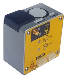
The ILS captures and continuously registers the incident and diffuse light at the time of each single shot, at the same multispectral bandwidth intervals. Radiance data for each single shot in each single band is related to GPS positioning data and ambient conditions data (temperature, humidity, orientation, exposure, and sun position) at the time of acquisition, allowing correct correction of the multispectral data, which is so comparable with satellite data (WorldView-2 or Sentinel-2 data) or multitemporal surveys carried out with the same arrangements. It provides environmental incident light data thanks to a sensor for measuring ambient light and recording the average reflectance, exposure time and environmental data for each shot, which are all useful parameters for the appropriate radiometric correction of the images acquired by MAIA in the 9 bands.
The MAIA Multispectral Camera provides fine regolation of all parameters related to the acquisition of the images, from the exposure time of each sensor, to their exposure frequency. The automatic configurations supplied are suitable for standard use.