Wheat Lodging Assessment Using Multispectral UAV Data
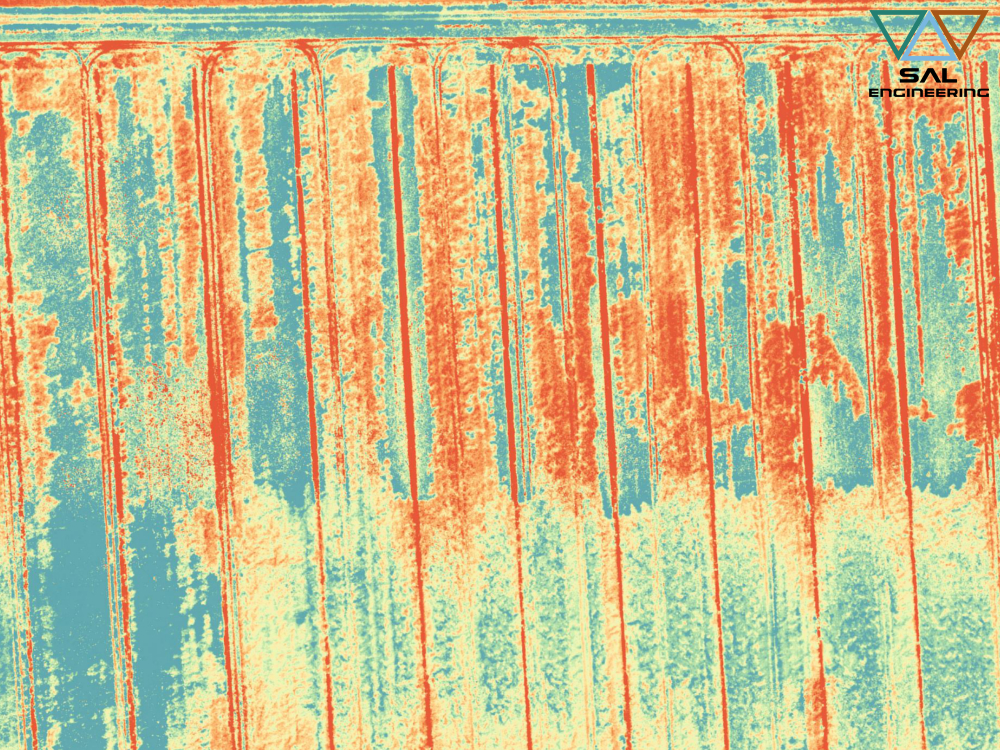
In 2018 we conducted a multispectral campaign using MAIA S2 on wheat fields that had lodging problems. We planned the photogrammetric paths, agreed with agronomists and technicians the geometric resolution and the products that we had to derive from the photogrammetric and multispectral survey, then we set the parameters of MAIA to obtain the correct radiometric information in each band, in such a way as to provide all the data useful for both radiometric and geometric analysis, thus developing a field of study that will have great applications in the future: 3D multispectral data analysis. In our processing lab, we then processed the data and obtained multispectral DSM, multispectral orthophotos and a large dataset of radiometric and geometric sample measurements. Thanks to the study of a team of Italian and Dutch experts, that data acquisition service resulted in a scientific publication.
For the first time, high-resolution multispectral data from a UAV with nine spectral bands (the same as Sentinel-2) covering the 390-950 nm wavelength region has been utilized for lodging assessment. This enabled a comparison of spectral variability across nine bands. Overall, we found that there was an increase in the magnitude of reflectance spectra as the lodging became more severe. The increase was more pronounced in the green, red-edge and NIR regions of the spectrum, thereby showing the sensitivity of these bands to changes in the crop canopy structure. Furthermore, the overall classification accuracy was very high (90%) where NL, ML, and SL classes were separated with reasonable accuracy while there was some mixing of VSL class with the other groups. To conclude, bands in the range of 700- 950nm can effectively detect lodging in wheat. These results underline how multispectral data can be an advancement with respect to conventional RGB camera traditionally mounted on the UAV platforms. Although we believe that these results are transferable to different crop varieties and growing conditions, further research is required to assess this.
Click here below to read and download the article:
Wheat Lodging Assessment Using Multispectral UAV Data
S. Chauhan 1, R. Darvishzadeh 1, Y.Lu 1, D. Stroppiana 2, M. Boschetti 2, M. Pepe 2, A. Nelson 1
1 Faculty of Geo-information Science and Earth Observation (ITC), University of Twente, Enschede 7500AE, The Netherlands – (s.chauhan, a.nelson, r.darvish)@utwente.nl, y.lu-3@student.utwente.nl
2 CNR-IREA, Institute for Electromagnetic Sensing of the Environment, National Research Council, 20133 Milano, Italy – (stroppiana.d, boschetti.m, pepe.m)@irea.cnr.it
The International Archives of the Photogrammetry, Remote Sensing and Spatial Information Sciences, Volume XLII-2/W13, 2019 ISPRS Geospatial Week 2019, 10–14 June 2019, Enschede, The Netherlands
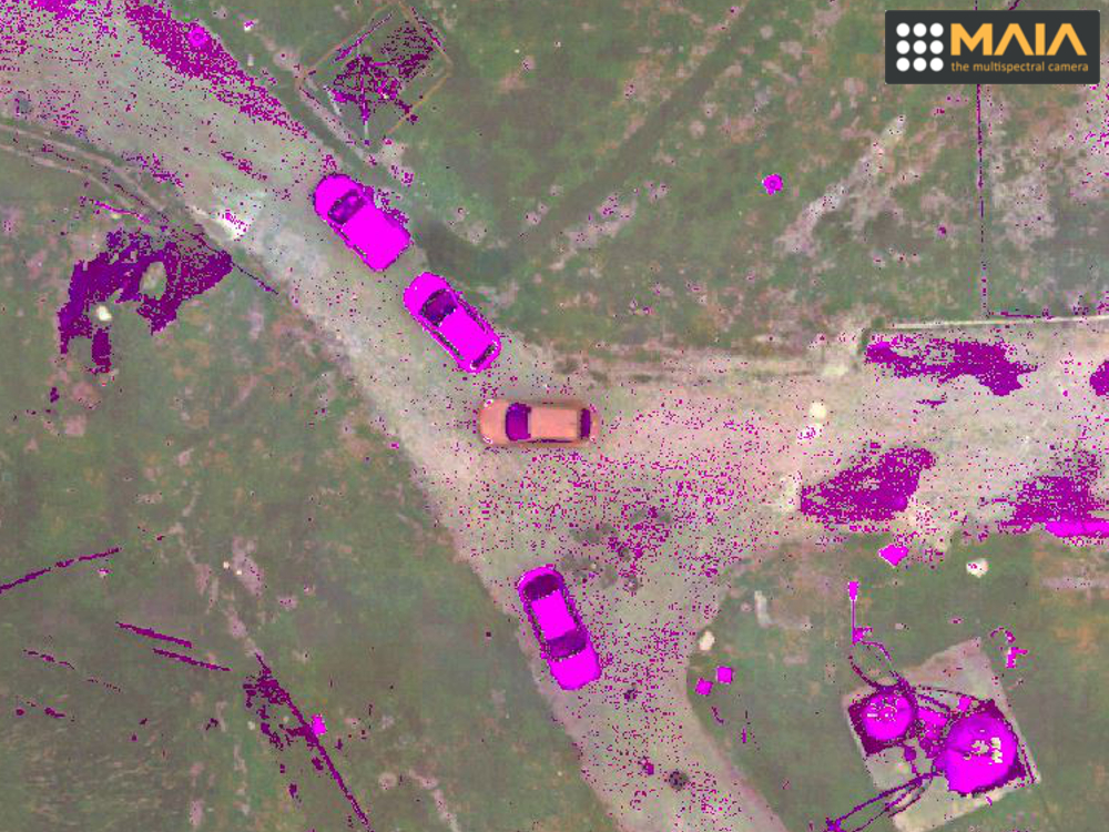
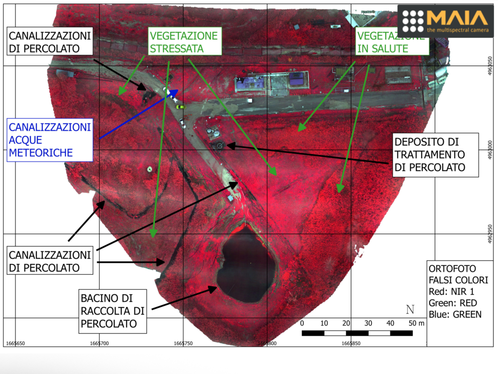 The University of Modena and Reggio Emilia has also conducted studies, research and insights on the data obtained, also through the thesis of Dr. Lisa Mosconi. The purpose of this thesis is to investigate the potential and problems related to the use of multispectral images acquired by sensors mounted on board of remotely piloted aircraft (APR), also called more commonly drones, for applications of environmental sciences and environmental protection.
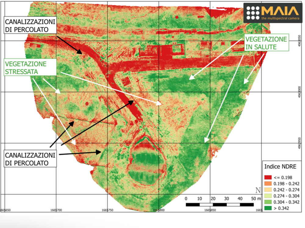 These sensors are sensitive to radiation emitted or reflected on different wavelength intervals of the electromagnetic spectrum, from the visible region (VIS) to that of the near infrared (NIR) and it is precisely this ability to observe beyond the visible, side by side of the ‘high geometric resolution that can be obtained, which makes them particularly interesting for environmental investigations. The acquired data allow to obtain information regarding the stress or vigor of the vegetation, aspects that can also be correlated to other information depending on the territory considered.