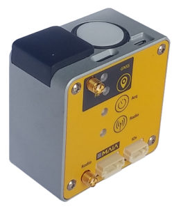
ILS: the Incident Light Sensor designed for environmental monitoring and precision agriculture
ILS – Incident Light Sensor provides irradiance data at the exact time of shooting for each image and in each spectral band, substantially improving the accuracy of radiometric correction and allowing to conduct multi-temporal multispectral surveys.
Thanks to a renewed cutting-edge software technology for measuring incident light during the survey and thanks to the possibility to manage information related to the position of the sun, ILS now provides more accurate and reliable data.
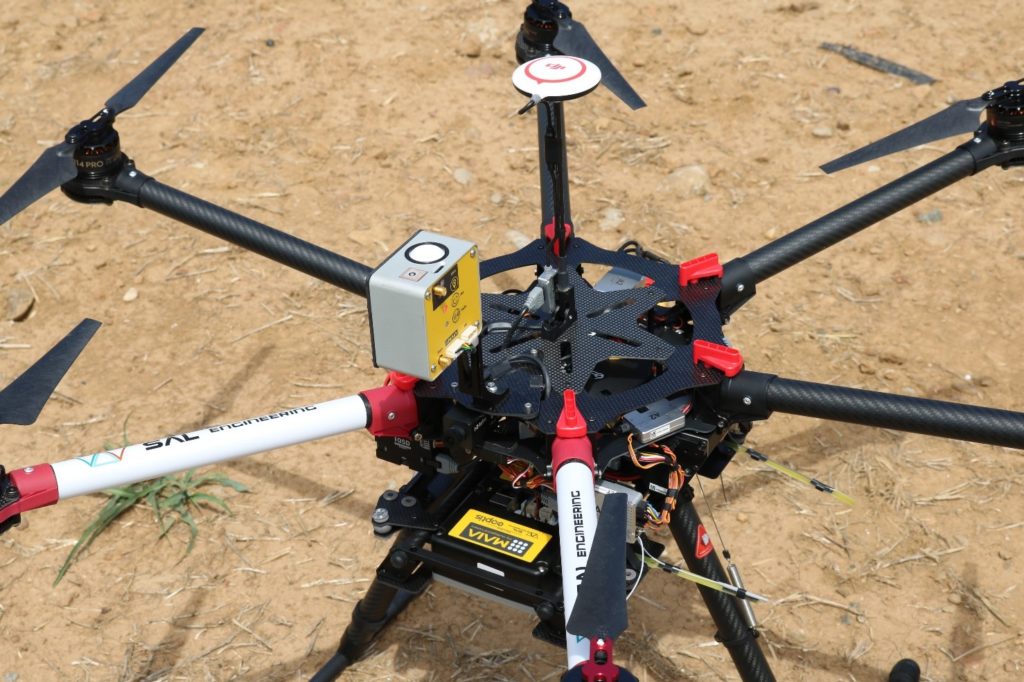
The multispectral data acquisition system composed by MAIA and ILS writes the exposure and reflectance data of the momentary incident light referring to each single shot of the camera, together with positioning data, environmental data and aircraft asset.
The internal GNSS positioning system provides the precise position of the MAIA multispectral images, but most of all the solution with double GNSS receiver, where one ILS serves as a master base and the other acts as a rover onboard RPAS, gives the possibility to process GNSS data in RTK mode (Real-Time Kinematic), ensuring accuracy close to the centimeter for shots positions.
This aspect triples the speed of photogrammetric processing in the main software based on structure from motion algorythms, and allows to obtain accurate data in a very short time. The RTK solution allows to have an accurate positioning of the center of image, which is fundamental when it is necessary to acquire a sample of images in certain points to investigate a physical phenomenon.
Again, this is of fundamental interest in the field of precision agriculture and environmental protection, where it is important to have a mapping of the conditions ex ante and ex post a natural event, a human action, an unexpected episode, a seasonal evolution.
Agronomic companies, universities and research institutes dealing with agronomic research have for years included data from multispectral survey within the method of data processing and modeling of forecast scenarios.