“Wheat Lodging Assessment Using Multispectral UAV Data” on ISPRS Archives

maia s2


Wheat Lodging Assessment Using Multispectral UAV Data

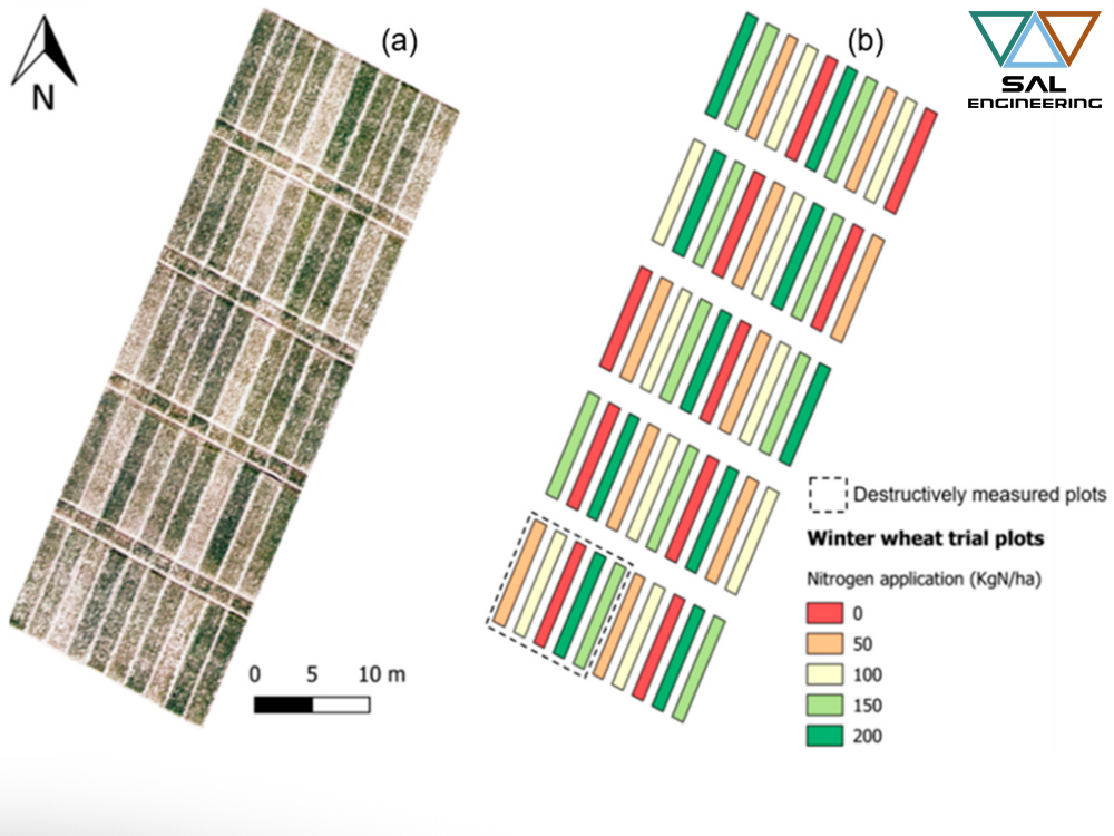
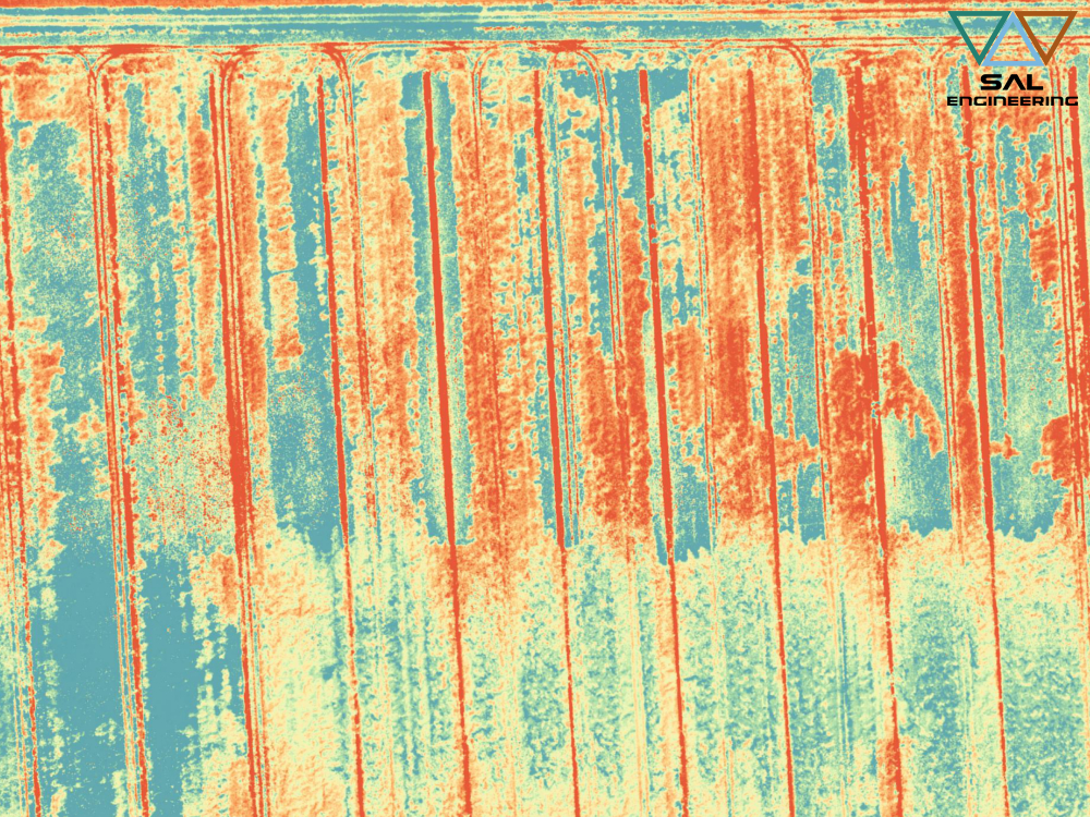
In 2018 we conducted a multispectral campaign using MAIA S2 on wheat fields that had lodging problems. We planned the photogrammetric paths, agreed with agronomists and technicians the geometric resolution and the products that we had to derive from the photogrammetric and multispectral survey, then we set the parameters of MAIA to obtain the correct radiometric information in each band, in such a way as to provide all the data useful for both radiometric and geometric analysis, thus developing a field of study that will have great applications in the future: 3D multispectral data analysis. In our processing lab, we then processed the data and obtained multispectral DSM, multispectral orthophotos and a large dataset of radiometric and geometric sample measurements. Thanks to the study of a team of Italian and Dutch experts, that data acquisition service resulted in a scientific publication.

For the first time, high-resolution multispectral data from a UAV with nine spectral bands (the same as Sentinel-2) covering the 390-950 nm wavelength region has been utilized for lodging assessment. This enabled a comparison of spectral variability across nine bands. Overall, we found that there was an increase in the magnitude of reflectance spectra as the lodging became more severe. The increase was more pronounced in the green, red-edge and NIR regions of the spectrum, thereby showing the sensitivity of these bands to changes in the crop canopy structure. Furthermore, the overall classification accuracy was very high (90%) where NL, ML, and SL classes were separated with reasonable accuracy while there was some mixing of VSL class with the other groups. To conclude, bands in the range of 700- 950nm can effectively detect lodging in wheat. These results underline how multispectral data can be an advancement with respect to conventional RGB camera traditionally mounted on the UAV platforms. Although we believe that these results are transferable to different crop varieties and growing conditions, further research is required to assess this.

Click here below to read and download the article:

Wheat Lodging Assessment Using Multispectral UAV Data 

S. Chauhan 1, R. Darvishzadeh 1, Y.Lu 1, D. Stroppiana 2, M. Boschetti 2, M. Pepe 2, A. Nelson 1
1 Faculty of Geo-information Science and Earth Observation (ITC), University of Twente, Enschede 7500AE, The Netherlands – (s.chauhan, a.nelson, r.darvish)@utwente.nl, y.lu-3@student.utwente.nl
2 CNR-IREA, Institute for Electromagnetic Sensing of the Environment, National Research Council, 20133 Milano, Italy – (stroppiana.d, boschetti.m, pepe.m)@irea.cnr.it

The International Archives of the Photogrammetry, Remote Sensing and Spatial Information Sciences, Volume XLII-2/W13, 2019 ISPRS Geospatial Week 2019, 10–14 June 2019, Enschede, The Netherlands
“Quantifying Uncertainty and Bridging the Scaling Gap in the Retrieval of Leaf Area Index by Coupling Sentinel-2 and UAV Observations” on Remote Sensing journal


Quantifying Uncertainty and Bridging the Scaling Gap in the Retrieval of Leaf Area Index by Coupling Sentinel-2 and UAV Observations

Even within managed crop systems, there is considerable and important within-field variation in LAI at scales finer than the resolution of current satellite imagers.
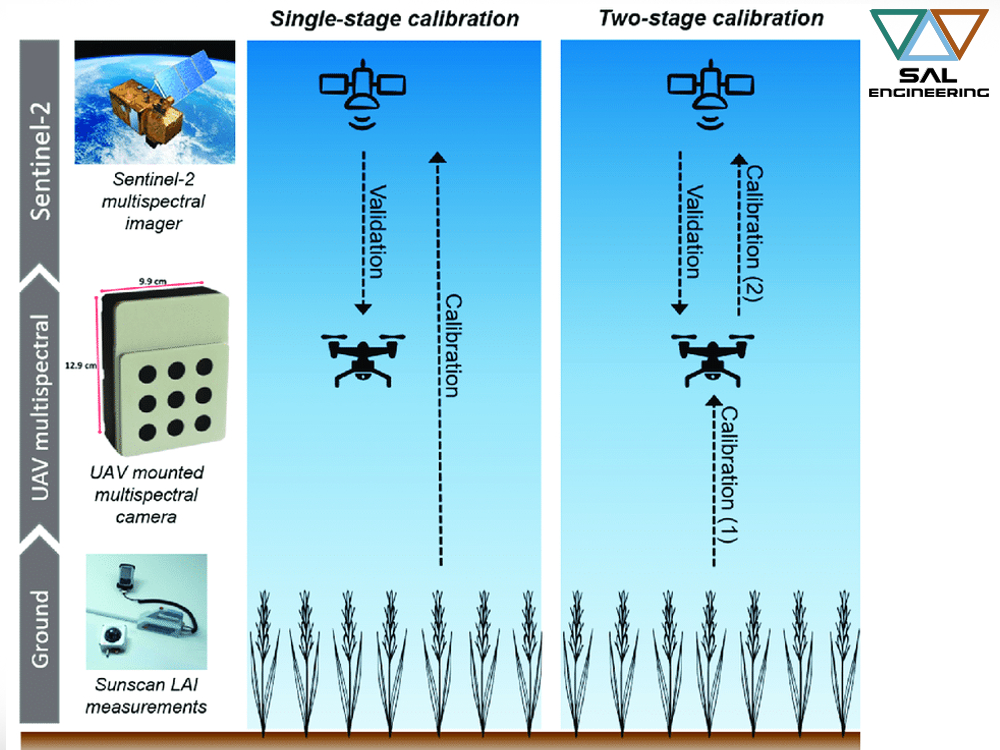
In this scientific research it is demonstrated that UAV multispectral observations at the cm scale, acquired from a sensor designed to match Sentinel-2 spectral bands, improve interpretation of the satellite signal.
Furthermore, the fine-scale resolution of the UAV sensor provides a tool for accurately upscaling LAI ground measurements, which were collected in coordination with the UAV flights, to satellite resolution. The within-field variance in spectral data resolved from the UAV observations was linked to wheat growth stage. Consequently, the Sentinel-2 and UAV platform data were more comparable at the later growth stages, when the vegetation canopy appeared more homogeneous due to a reduced influence of bare soil.
Calibrating models used to retrieve LAI from Sentinel-2 observations directly from ground measurements performed poorly and were unable to explain the variance in LAI throughout the growing season. On the other hand, our novel two-stage model calibration, involving the use of upscaled UAV LAI estimates, demonstrated a clear improvement in the accuracy of LAI retrievals from Sentinel-2 data, reducing bias strongly.
This study has highlighted the value of UAV observations for eectively providing a link between point measurements on the ground and 20-m resolution multispectral observations made from the Sentinel-2 satellite.
Click here below to read the article:

“The Value of Sentinel-2 Spectral Bands for the Assessment of Winter Wheat Growth and Development” on Remote Sensing journal


The Value of Sentinel-2 Spectral Bands for the Assessment of Winter Wheat Growth and Development

We are proud to share the scientific publication of some researchers who have chosen our multispectral data acquisition system since the initial days when we were in the design and development phase. Below you will find the abstract and the link to access the scientific journal.

Leaf Area Index (LAI) and chlorophyll content are strongly related to plant development and productivity. Spatial and temporal estimates of these variables are essential for efficient and precise crop management. The availability of open-access data from the European Space Agency’s (ESA) Sentinel-2 satellite—delivering global coverage with an average 5-day revisit frequency at a spatial resolution of up to 10 metres—could provide estimates of these variables at unprecedented (i.e., sub-field) resolution. Using synthetic data, past research has demonstrated the potential of Sentinel-2 for estimating crop variables. Nonetheless, research involving a robust analysis of the Sentinel-2 bands for supporting agricultural applications is limited. In this scientific contribution, it is evaluated the potential of Sentinel-2 data for retrieving winter wheat LAI, leaf chlorophyll content (LCC) and canopy chlorophyll content (CCC). In coordination with destructive and non-destructive ground measurements, the team acquired multispectral data from an Unmanned Aerial Vehicle (UAV)-mounted sensor measuring key Sentinel-2 spectral bands (443 to 865 nm). They applied Gaussian processes regression (GPR) machine learning to determine the most informative Sentinel-2 bands for retrieving each of the variables. They further evaluated the GPR model performance when propagating observation uncertainty. When applying the best-performing GPR models without propagating uncertainty, the retrievals had a high agreement with ground measurements—the mean R2 and normalised root-mean-square error (NRMSE) were 0.89 and 8.8%, respectively. When propagating uncertainty, the mean R2 and NRMSE were 0.82 and 11.9%, respectively. When accounting for measurement uncertainty in the estimation of LAI and CCC, the number of most informative Sentinel-2 bands was reduced from four to only two—the red-edge (705 nm) and near-infrared (865 nm) bands.

This research demonstrates the value of the Sentinel-2 spectral characteristics for retrieving critical variables that can support more sustainable crop management practices.

Click here below to read and download the scientific article:


The Value of Sentinel-2 Spectral Bands for the Assessment of Winter Wheat Growth and Development

Andrew Revill 1 Anna Florence 2 Alasdair MacArthur 1Stephen P. Hoad 2  Robert M. Rees 2 and Mathew Williams 1
1
School of GeoSciences and National Centre for Earth Observation, University of Edinburgh
2
Crop & Soils Systems, Scotland’s Rural College, Edinburgh

“Quantitative Remote Sensing at Ultra-High Resolution” on Remote Sensing journal

“Quantitative Remote Sensing at Ultra-High Resolution” on Remote Sensing journal

“Overall, we expect that UAV spectral sensing systems will become common in the toolbox of researchers in quantitative remote sensing, forestry, agriculture, field phenotyping, ecology, and other fields that rely on environmental monitoring. […] In combination with commercially built fixed-wing or rotary-wing UAVs, these cameras are becoming a powerful tool for researchers, as their rapid adaption shows, but also for service providers, breeding companies, and even farmers”.

We are happy that our work of design, study, experimentation, data acquisition and processing is leading to great satisfaction in the world of scientific research. In the paper linked below and published on Remote Sensing journal, you can read a review of the most important technological innovations regarding the high resolution multispectral survey. And MAIA is certainly counted among them.

“The important tasks now are to standardize procedures, develop algorithms, and explore the
potential to make use of the large amounts of multi-dimensional, high spatial, temporal, and spectral resolution UAV data. In this review, we showed that many approaches exist, and identified best practice procedures to derive calibrated spectral data from UAV sensing systems”.

You can read and download the paper by clicking on the link below.

Quantitative Remote Sensing at Ultra-High Resolution with UAV Spectroscopy: A Review of Sensor Technology, Measurement Procedures, and Data Correction Workflows

Authors: Helge Aasen, Eija Honkavaara, Arko Lucieer, Pablo J. Zarco-Tejada

“Geometric calibration and radiometric correction of the MAIA Multispectral Camera” on ISPRS Archives

Geometric calibration and radiometric correction of the MAIA Multispectral Camera

As a result of the Conference “Frontiers in Spectral imaging and 3D Technologies for Geospatial Solutions” that took place in Jyväskylä, Finland, on 25-27 October 2017, a paper has been discussed, published and scientifically reviewed. The title of the article is “Geometric calibration and radiometric correction of the MAIA Multispectral Camera” and it is published on “The International Archives of the Photogrammetry, Remote Sensing and Spatial Information Sciences, Volume XLII-3/W3, 2017”.  This article has been peer-reviewed.

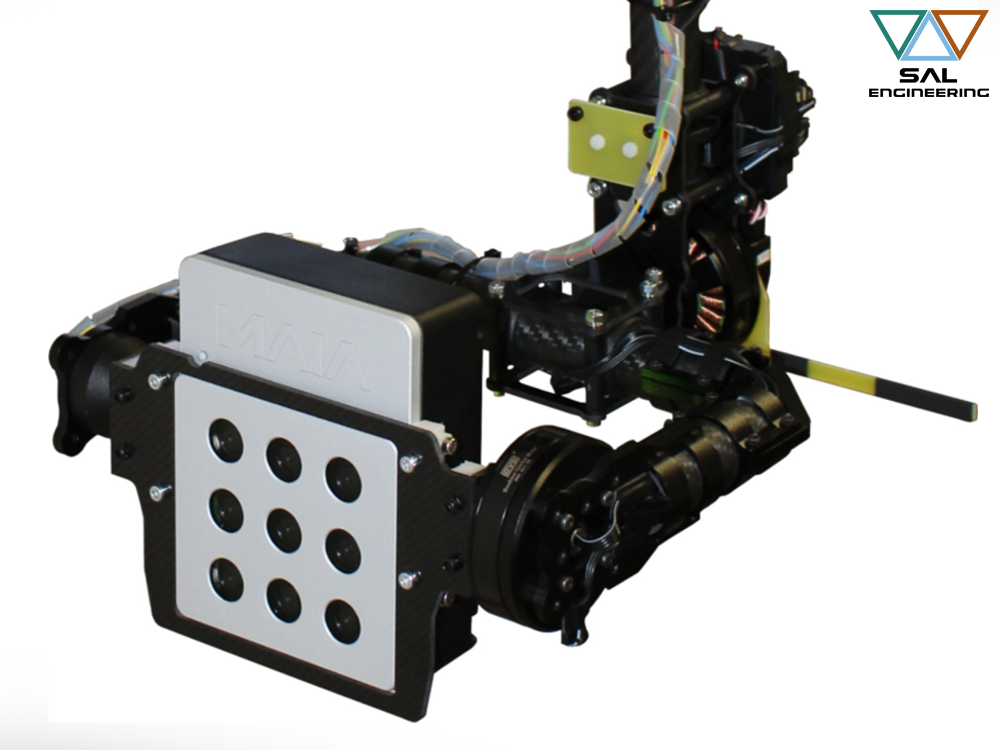
Multispectral imaging is a widely used remote sensing technique, whose applications range from agriculture to environmental monitoring, from food quality check to cultural heritage diagnostic. A variety of multispectral imaging sensors are available on the market, many of them designed to be mounted on different platform, especially small drones. This work focuses on the geometric and radiometric characterization of a brand-new, lightweight, low-cost multispectral camera called MAIA. The MAIA camera is equipped with nine sensors, allowing for the acquisition of images in the visible and near infrared parts of the electromagnetic spectrum.
You can read and download the paper by clicking on the link below.

“Last generation instrument for agriculture multispectral data collection” on CIGR

“Last generation instrument for agriculture multispectral data collection” on CIGR journal

We at SAL Engineering are really proud to announce that the article entitled “Last generation instrument for agriculture multispectral data collection” has been published on the well-known magazine Agricultural Engineering International: CIGR Journal. This article has been written by the Research&Development team of SAL and Eoptis, with the contribution of eminent scientists and researchers.

HERE you can read and download the full article.