MAIA M2 is the new lightest modular multispectral camera
The potential offered by RPAS (Remotely Piloted Aircraft Systems) in environmental prevention and monitoring is related to the possibility for sensors to fly over areas of interest. In the last decade proximal sensing technology saw a great development both with regard to sensors (lightweight multispectral and iperspectral sensors) and platforms (aircraft, helicopters, RPAS). Research and development in photogrammetric and multispectral surveys is offering new innovative solutions in sensors and technologies to monitor our environmental resources with very high frequency, precision and reliability.
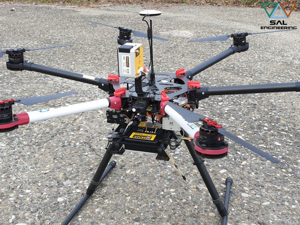
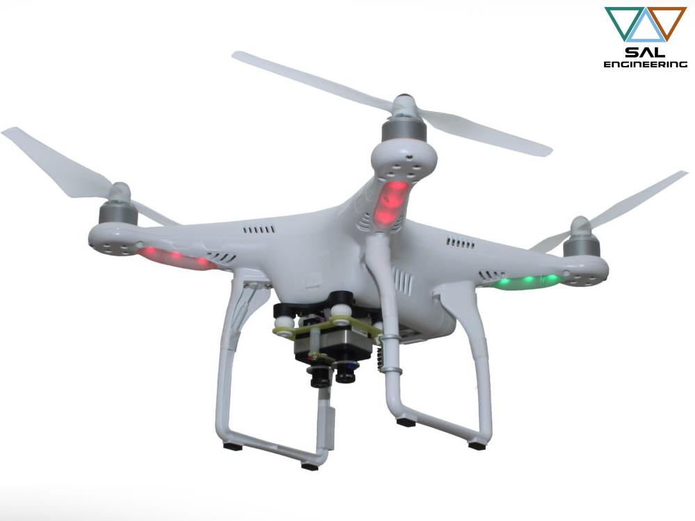
MAIA is the most advanced multispectral camera designed to be employed onboard UAV systems, airplanes and terrestrial rovers as well, jointly developed and made in Italy by SAL Engineering, that designs and manufactures systems for data acquisition in sea, air, land environments, EOPTIS, specialized in designing and manufacturing opto-electronic measurement instruments, and 3DOM Research Unit of Fondazione Bruno Kessler, that is actively involved in accurate measurements and reality-based 3D reconstruction issues. In this team the Italian excellence in the fields of physics, optics, geomatics, 3D modeling and remote sensing have been concentrated: a consolidated know-how was made available for the construction of a multispectral imagery acquisition instrument that could ensure scientific rigor and total control of geometrical and radiometric data for a correct multispectral survey.
Regarding the differentiation of wavelenght intervals along the electromagnetic spectrum, MAIA has been designed according to two main sets: MAIA WV and MAIA S2. Nevertheless, thanks to the profitable collaboration with agronomic consulting companies and environmental protection agencies, or with universities and research institutes, a fully customizable modular solution was subsequently developed.
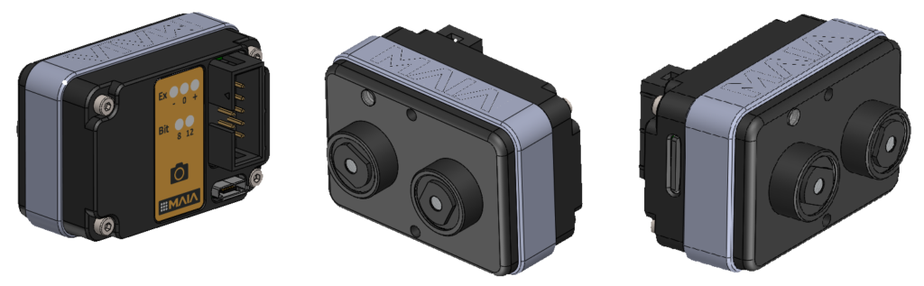
MAIA M2, in fact, is the new modular multispectral camera that the user can customize with a large portfolio of VIS-NIR bandpass filters, according to his needs.
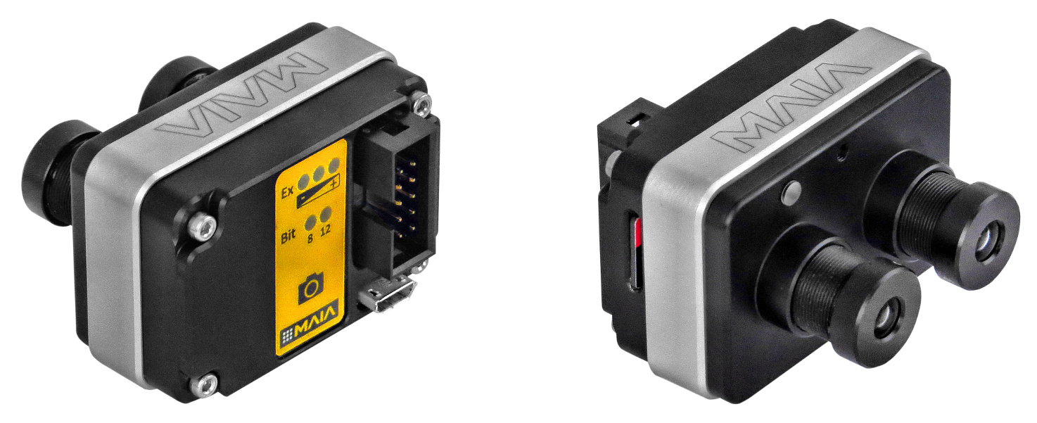
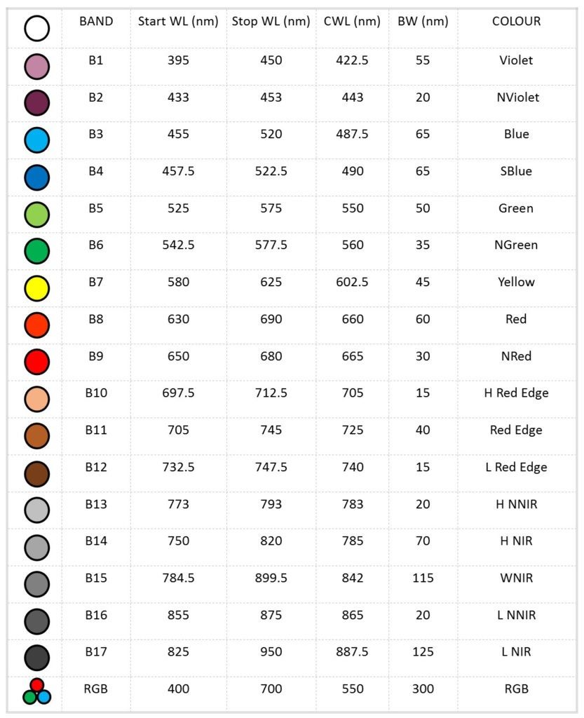
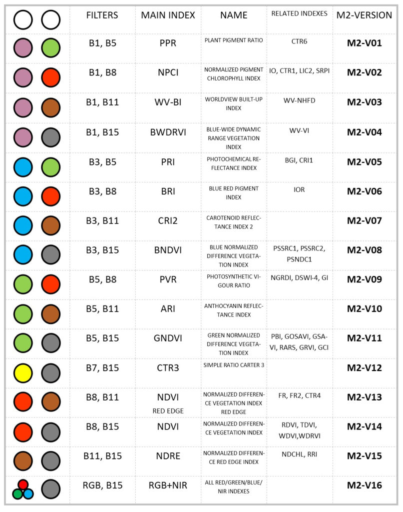
The MAIA M2 single module can be composed using a pair of available band-pass filters. The choice of the pre-selected filter pairs will be made according to the most widely used multispectral indexes with two single bands, or on the basis of the aim of the multispectral survey. In the following table you can see the selected filters that are available in stock:
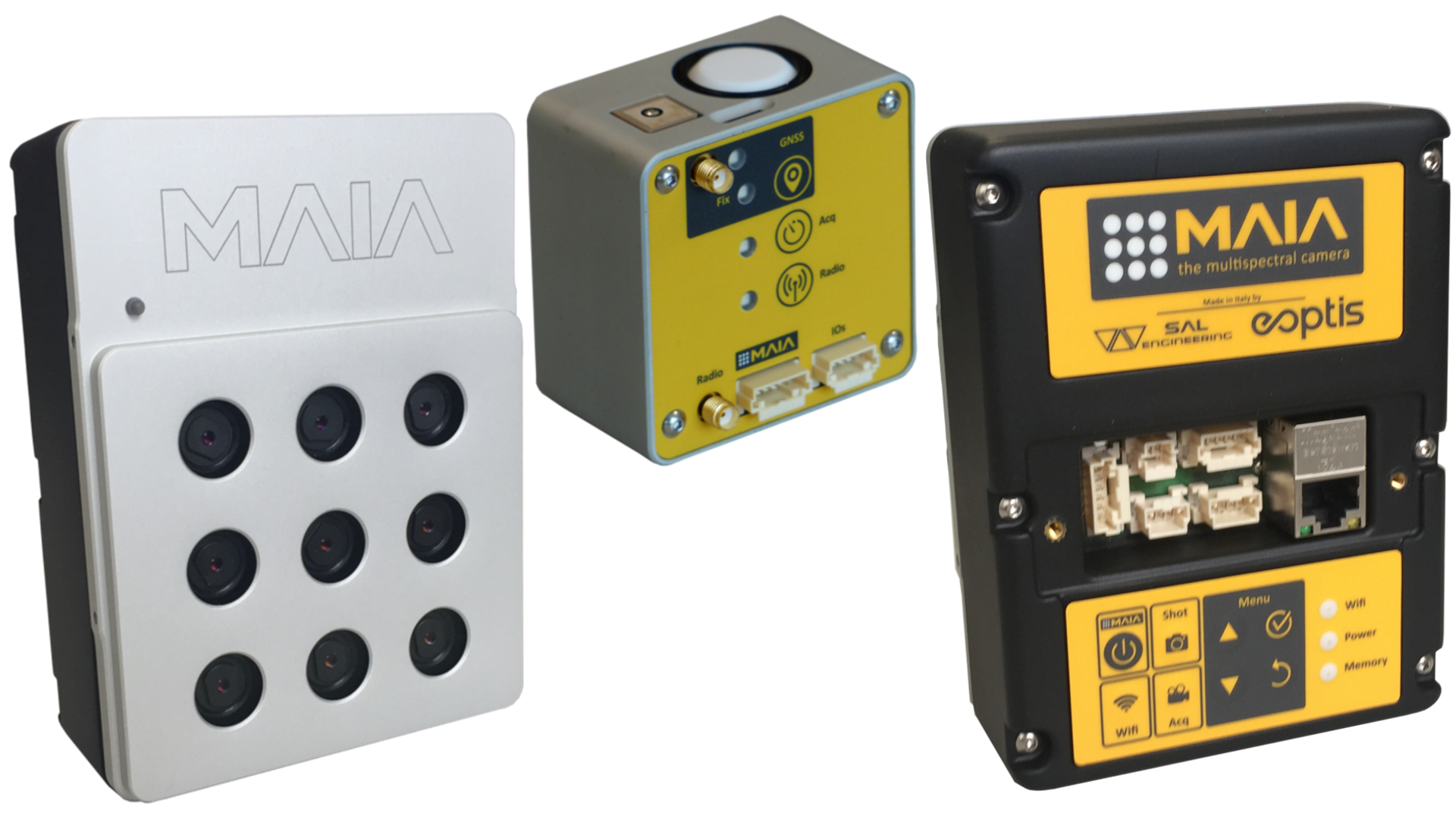
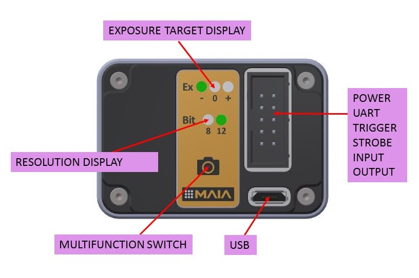
Each module has stand-alone capability with external trigger and strobe or free run mode, and presents several inputs/outputs for external devices interfacing such as trigger, strobe, serial port, USB and two aux port. The module/camera is based on a double global shutter CMOS sensor with 8/12 bits resolution and automatic exposure with selectable target value.
Single module of MAIA M2 has the lowest values in the market of modular multispectral cameras in terms of size (48 mm X 33 mm X 23 mm), weight (70 g) and price (1990 € until July 15th), but it presents the highest values in terms of resolution and sensitivity of sensors.
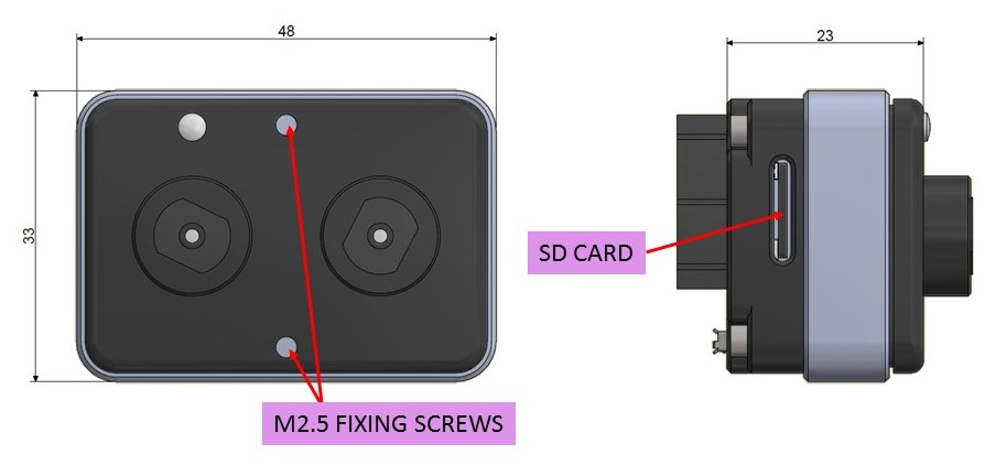
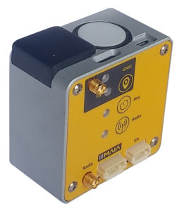
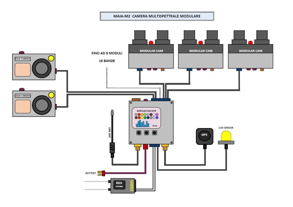
Multi-module management, up to 8 modules, is possible using the external MAIA M2 Control Unit that manages the images synchronization and geo-referencing, the powering of modules, the reading of PWM inputs, the light sensor input, two outputs with customizable variable advance for delay compensation of any connected DSLR cameras. An RTK version of MAIA M2 Control Unit is supplied including the GNSS antenna, the UHF antenna, the Lux Sensor and the connection cables for batteries, PWM inputs and DSLR shutter input. Multispectral raw images and parameters are stored in a removable SD card, and they can be downloaded from USB in order to be pre-processed with MultiCam Stitcher Pro, the MAIA images pre-processing software.
The following table shows some combinations of 2 or more MAIA M2 modules, useful to allow the calculation of many of the main multispectral indexes:
MAIA is basically the proper instrument for your multispectral survey.
You can detect VIS-NIR informations through 9 global shutter sensors with high resolution and top sensitivity; next, you have the total control on creating your dataset of undistorted and geometrically corrected images for reflectance analysis, indexes calculation and photogrammetric processing. You can then make decisions on monitoring crops, wineyards, forests and coastal environments, in order to safeguard ecosystems and to make your agronomic system more efficient. Along with the camera, an image processing software will be provided for correction of geometric and radial distorsion, for coregistration (pixel-pixel convergence) of RAW multispectral images acquired with MAIA, with tools for indexes calculation and for band combinations.
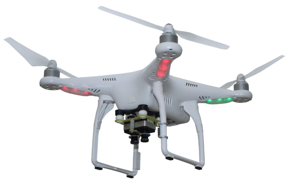
Since its foundation, SAL Engineering has participated, contributing with the design and management of data acquisition, synchronization and processing systems, to several projects with agronomic and precision farming companies, or environmental protection agencies that deal with natural environments such as coastal dunes, forests, reclaimed sites, areas with high environmental risk.
SAL Engineering is a company specialized in photogrammetric surveys based in Italy: visit our website www.salengineering.it.
For any further information about services and products, send us an email at info@salengineering.it.
For any detailed information about products and technologies that deal with multispectral surveys, please contact us. SAL Engineering is providing accurate multispectral data to companies specialized in agronomic consulting thanks to our integrated systems based on platform, control system and sensors.
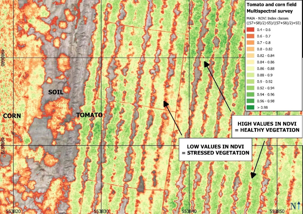
MAIA WV is the multispectral camera equipped with the same wavelenght intervals of the WorldView-2™ satellite owned by DigitalGlobe. Now, you can compare satellite data with high-resolution maps obtained through a multispectral survey conducted with MAIA WV mounted on your UAV, getting centimeters-level precision and accuracy. WorldView-2™ is a commercial earth observation satellite that provides eight-band multispectral imagery with 1.84 m resolution, in support of services such as agriculture, forest monitoring, land cover changes and natural disaster management. MAIA WV multispectral camera is based on an array of 9 sensors (1 RGB and 8 monochrome with relative band-pass filters) to detect multispectral imagery in the VIS-NIR spectrum from 390 nm to 950 nm: MAIA WV is the most advanced broadband multispectral camera for RPAS, aircrafts, terrestrial rovers available today, with bands in Coastal and Blue spectrum region.
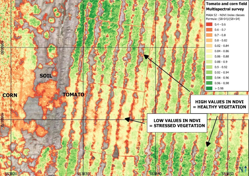
MAIA S2 is the multispectral camera equipped with the same wavelenght intervals of the European Spatial Agency‘s Sentinel-2™ satellite. Sentinel-2™ is an earth observation mission developed by ESA as part of the Copernicus Programme to perform observations in support of services such as precision agriculture, forest monitoring, land cover changes detection, and natural disaster management. Now, you can compare free satellite data with high-resolution maps obtained through a multispectral survey conducted with MAIA S2, the multispectral camera with two narrow spectral bands both in Red Edge and in NIR region.