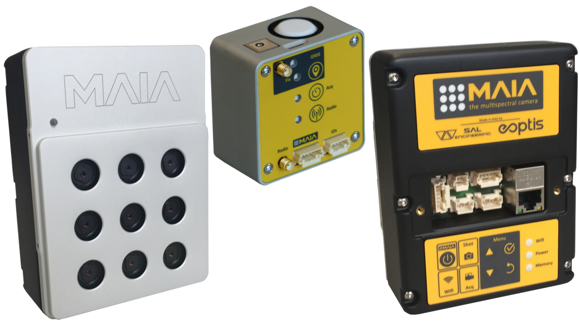
MAIA + ILS for environmental monitoring and precision agriculture


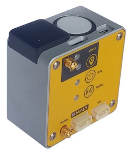
ILS: the Incident Light Sensor designed for environmental monitoring and precision agriculture

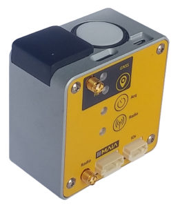
ILS – Incident Light Sensor provides irradiance data at the exact time of shooting for each image and in each spectral band, substantially improving the accuracy of radiometric correction and allowing to conduct multi-temporal multispectral surveys.

Thanks to a renewed cutting-edge software technology for measuring incident light during the survey and thanks to the possibility to manage information related to the position of the sun, ILS now provides more accurate and reliable data.

The multispectral data acquisition system composed by MAIA and ILS writes the exposure and reflectance data of the momentary incident light referring to each single shot of the camera, together with positioning data, environmental data and aircraft asset.


The internal GNSS positioning system provides the precise position of the MAIA multispectral images, but most of all the solution with double GNSS receiver, where one ILS serves as a master base and the other acts as a rover onboard RPAS, gives the possibility to process GNSS data in RTK mode (Real-Time Kinematic), ensuring accuracy close to the centimeter for shots positions.

This aspect triples the speed of photogrammetric processing in the main software based on structure from motion algorythms, and allows to obtain accurate data in a very short time. The RTK solution allows to have an accurate positioning of the center of image, which is fundamental when it is necessary to acquire a sample of images in certain points to investigate a physical phenomenon.


Again, this is of fundamental interest in the field of precision agriculture and environmental protection, where it is important to have a mapping of the conditions ex ante and ex post a natural event, a human action, an unexpected episode, a seasonal evolution.

Agronomic companies, universities and research institutes dealing with agronomic research have for years included data from multispectral survey within the method of data processing and modeling of forecast scenarios.


Come and discover on the dedicated page or on Geo-Matching all the technical features of ILS, the Incident Light Sensor designed for science-based multispectral surveys.

MAIA M2: the modular multispectral camera


MAIA M2 is the new lightest modular multispectral camera

The potential offered by RPAS (Remotely Piloted Aircraft Systems) in environmental prevention and monitoring is related to the possibility for sensors to fly over areas of interest. In the last decade proximal sensing technology saw a great development both with regard to sensors (lightweight multispectral and iperspectral sensors) and platforms (aircraft, helicopters, RPAS). Research and development in photogrammetric and multispectral surveys is offering new innovative solutions in sensors and technologies to monitor our environmental resources with very high frequency, precision and reliability.

MAIA is the most advanced multispectral camera designed to be employed onboard UAV systems, airplanes and terrestrial rovers as well, jointly developed and made in Italy by SAL Engineering, that designs and manufactures systems for data acquisition in sea, air, land environments, EOPTIS, specialized in designing and manufacturing opto-electronic measurement instruments, and 3DOM Research Unit of Fondazione Bruno Kessler, that is actively involved in accurate measurements and reality-based 3D reconstruction issues. In this team the Italian excellence in the fields of physics, optics, geomatics, 3D modeling and remote sensing have been concentrated: a consolidated know-how was made available for the construction of a multispectral imagery acquisition instrument that could ensure scientific rigor and total control of geometrical and radiometric data for a correct multispectral survey.

Regarding the differentiation of wavelenght intervals along the electromagnetic spectrum, MAIA has been designed according to two main sets: MAIA WV and MAIA S2. Nevertheless, thanks to the profitable collaboration with agronomic consulting companies and environmental protection agencies, or with universities and research institutes, a fully customizable modular solution was subsequently developed.
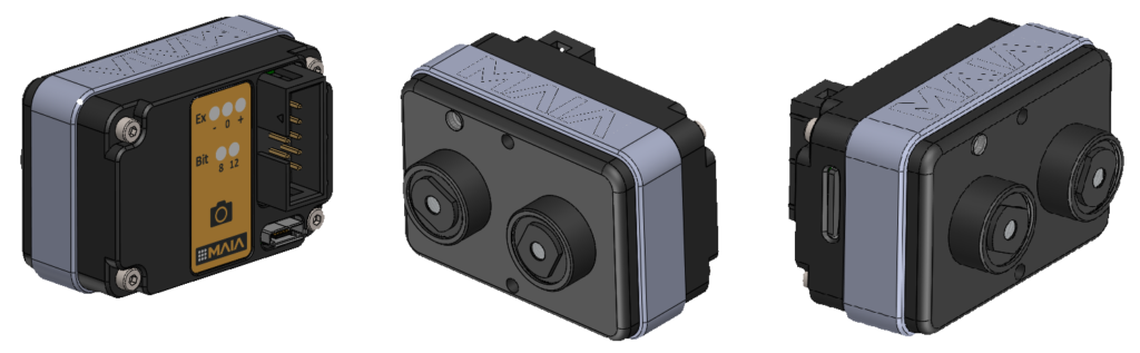
MAIA M2, in fact, is the new modular multispectral camera that the user can customize with a large portfolio of VIS-NIR bandpass filters, according to his needs.
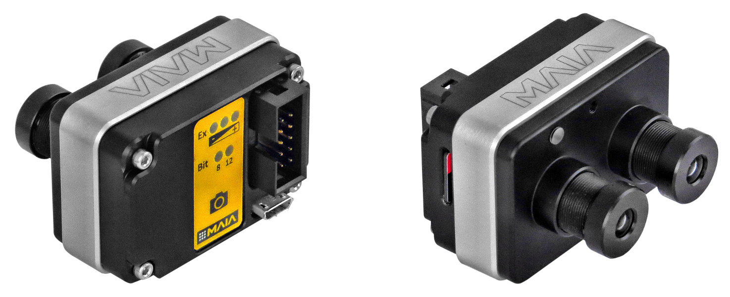
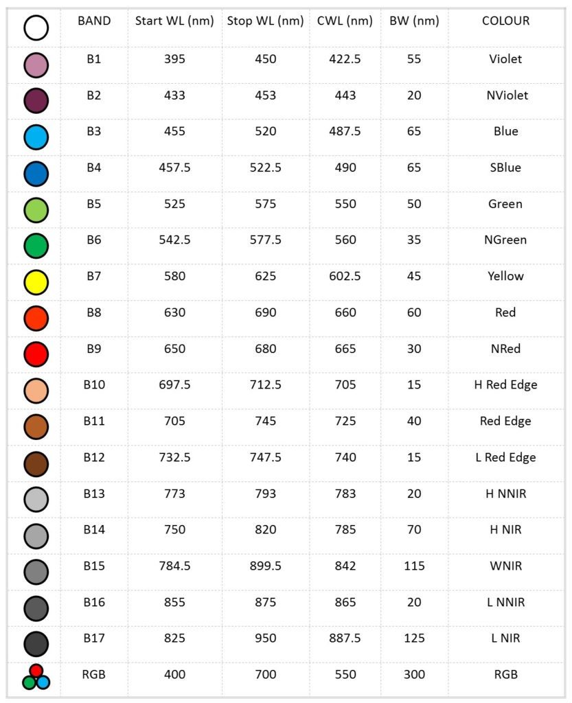
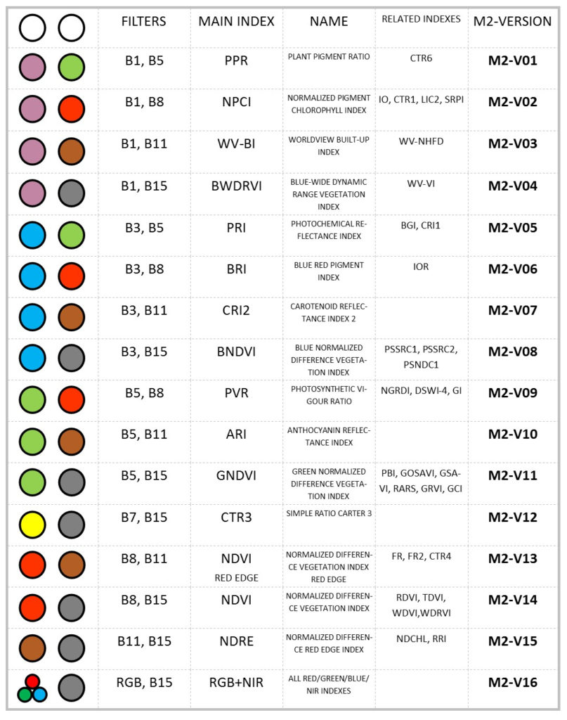
The MAIA M2 single module can be composed using a pair of available band-pass filters. The choice of the pre-selected filter pairs will be made according to the most widely used multispectral indexes with two single bands, or on the basis of the aim of the multispectral survey. In the following table you can see the selected filters that are available in stock:
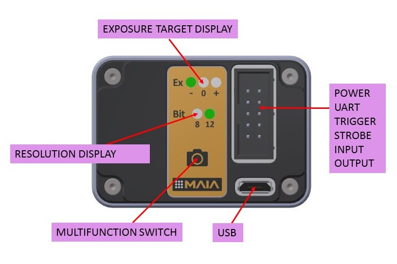
Each module has stand-alone capability with external trigger and strobe or free run mode, and presents several inputs/outputs for external devices interfacing such as trigger, strobe, serial port, USB and two aux port. The module/camera is based on a double global shutter CMOS sensor with 8/12 bits resolution and automatic exposure with selectable target value.
Single module of MAIA M2 has the lowest values in the market of modular multispectral cameras in terms of size (48 mm X 33 mm X 23 mm), weight (70 g) and price (1990 € until July 15th), but it presents the highest values in terms of resolution and sensitivity of sensors.
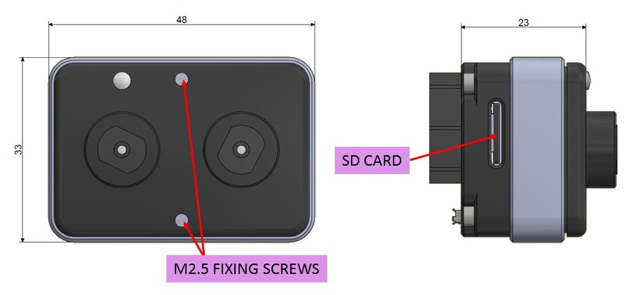
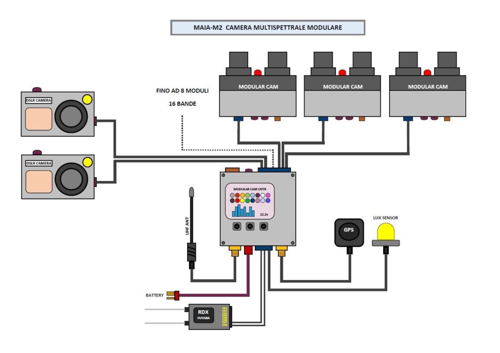
Multi-module management, up to 8 modules, is possible using the external MAIA M2 Control Unit that manages the images synchronization and geo-referencing, the powering of modules, the reading of PWM inputs, the light sensor input, two outputs with customizable variable advance for delay compensation of any connected DSLR cameras. An RTK version of MAIA M2 Control Unit is supplied including the GNSS antenna, the UHF antenna, the Lux Sensor and the connection cables for batteries, PWM inputs and DSLR shutter input. Multispectral raw images and parameters are stored in a removable SD card, and they can be downloaded from USB in order to be pre-processed with MultiCam Stitcher Pro, the MAIA images pre-processing software.

The following table shows some combinations of 2 or more MAIA M2 modules, useful to allow the calculation of many of the main multispectral indexes:
MAIA is basically the proper instrument for your multispectral survey.

You can detect VIS-NIR informations through 9 global shutter sensors with high resolution and top sensitivity; next, you have the total control on creating your dataset of undistorted and geometrically corrected images for reflectance analysis, indexes calculation and photogrammetric processing. You can then make decisions on monitoring crops, wineyards, forests and coastal environments, in order to safeguard ecosystems and to make your agronomic system more efficient. Along with the camera, an image processing software will be provided for correction of geometric and radial distorsion, for coregistration (pixel-pixel convergence) of RAW multispectral images acquired with MAIA, with tools for indexes calculation and for band combinations.
Since its foundation, SAL Engineering has participated, contributing with the design and management of data acquisition, synchronization and processing systems, to several projects with agronomic and precision farming companies, or environmental protection agencies that deal with natural environments such as coastal dunes, forests, reclaimed sites, areas with high environmental risk.

SAL Engineering is a company specialized in photogrammetric surveys based in Italy: visit our website www.salengineering.it.

For any further information about services and products, send us an email at info@salengineering.it.

For any detailed information about products and technologies that deal with multispectral surveys, please contact usSAL Engineering is providing accurate multispectral data to companies specialized in agronomic consulting thanks to our integrated systems based on platform, control system and sensors.
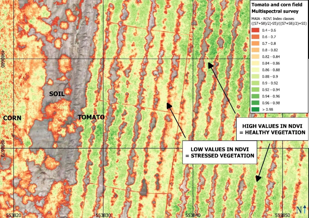
MAIA WV is the multispectral camera equipped with the same wavelenght intervals of the WorldView-2™ satellite owned by DigitalGlobe. Now, you can compare satellite data with high-resolution maps obtained through a multispectral survey conducted with MAIA WV mounted on your UAV, getting centimeters-level precision and accuracy. WorldView-2™ is a commercial earth observation satellite that provides eight-band multispectral imagery with 1.84 m resolution, in support of services such as agriculture, forest monitoring, land cover changes and natural disaster management. MAIA WV multispectral camera is based on an array of 9 sensors (1 RGB and 8 monochrome with relative band-pass filters) to detect multispectral imagery in the VIS-NIR spectrum from 390 nm to 950 nm: MAIA WV is the most advanced broadband multispectral camera for RPAS, aircrafts, terrestrial rovers available today, with bands in Coastal and Blue spectrum region.
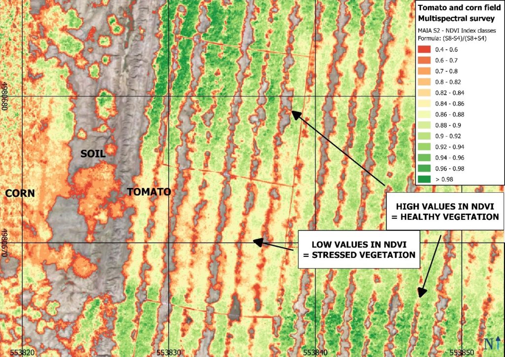
MAIA S2 is the multispectral camera equipped with the same wavelenght intervals of the European Spatial Agency‘s Sentinel-2™ satellite. Sentinel-2™ is an earth observation mission developed by ESA as part of the Copernicus Programme to perform observations in support of services such as precision agriculture, forest monitoring, land cover changes detection, and natural disaster management. Now, you can compare free satellite data with high-resolution maps obtained through a multispectral survey conducted with MAIA S2, the multispectral camera with two narrow spectral bands both in Red Edge and in NIR region.

The key features of the new-born MAIA M2, that presents the same quality of sensors, filters and optics of the standard versions WV and S2, are basically linked to the modular system and to the freedom to customize the set of bandpass filters, with excellent cost/benefit ratio and perfect physical adaptability onboard data acquisition platforms.

“Sensors of monitoring, from theory to field” on L’Informatore Agrario journal

“Sensors of monitoring, from theory to field” on L’ Informatore Agrario journal

We proudly share this article written by Francesco Marinello (Dipartimento Tesaf – Università di Padova and Neos srl), Marco Sozzi (Dipartimento Tesaf – Università di Padova) and Alessia Cogato (Dipartimento Tesaf – Università di Padova and Isiss G.B. Cerletti di Conegliano-Treviso) and published on the magazine L’Informatore Agrario (© 2018 Copyright Edizioni L’Informatore Agrario S.r.l.) concerning the characteristics of some multispectral sensors and their applications in Precision Agriculture.

The maps provided by multispectral sensors can be used for monitor the evolution of the crop cycle and, correlated with information on soil and weather and yields of the previous cycles, can be used to perform zonations and to create simulations. These operations are essential to predict productive trends and therefore to optimize treatments and agronomic inputs in the different areas identified.

Compared to satellites and proximal sensors, drones have peculiarity in flexibility of survey: this is fundamental in some phytosanitary or weeding treatments.

You can read and download the full article by clicking the link below.

Sensori di monitoraggio, dalla teoria al campo by L’Informatore Agrario


Credits: L’Informatore Agrario © 2018 Copyright Edizioni L’Informatore Agrario S.r.l.

Francesco Marinello, Luigi Sartori
Dipartimento Tesaf – Università di Padova e Neos srl

Marco Sozzi (Dipartimento Tesaf – Università di Padova)

Alessia Cogato (Dipartimento Tesaf – Università di Padova and Isiss G.B. Cerletti di Conegliano-Treviso)

“Which future for the employment of drones in agriculture?” on L’Informatore Agrario

“Which future for the employment of drones in Agriculture?” on L’Informatore agrario journal

We proudly share this article written by Francesco Marinello, Luigi Sartori (Dipartimento Tesaf – Università di Padova and Neos srl) and Simone Gatto (Dipartimento Tesaf – Università di Padova) and published on the magazine L’Informatore Agrario n°39 (© 2017 Copyright Edizioni L’Informatore Agrario S.r.l.) concerning the benefits of multispectral survey and of other survey tecnologies for Precision Agriculture. Here is a statement in which they talk about MAIA – The Multispectral Camera.

“Multispectral cameras are more and more useful instruments in Precision Agriculture. Their flexibility in use increases with the number of bands available. For example, MAIA (one of the most interesting instruments on the market, realized by SAL Engineering) with 9 monochromatic sensors in 9 different bands permits to calculate over 20 vegetational indices among the most common. Those indices are efficient in Precision Agriculture to define agronomical interventions in different vegetative moments of the colture, thanks to the support given by the prescription maps, in the planning of time and distribution of the harvest, in recognizing health deseases or points of maturation, and in general to evaluate the vegetative health status of the colture”.

You can read and download the full article by clicking the link below.

2017 39 Informatore Agrario

Credits:

L’Informatore Agrario © 2017 Copyright Edizioni L’Informatore Agrario S.r.l.

Francesco Marinello, Luigi Sartori
Dipartimento Tesaf – Università di Padova e Neos srl
Simone Gatto
Dipartimento Tesaf – Università di Padova

Benefits of precision agriculture: from EXPO 2015 to CAP 2014-2020

Benefits of precision agriculture: focus on Italy

Precision Agriculture, also known as Precision Farming, is a strategy in managing agriculture due to the potential of the widespread application of innovative solutions. According to its original meaning definitions, it consists in “applying technologies, principles and strategies for spatial and temporal management of variability associated with aspects of agricultural production” (Pierce and Nowak, 1999), in relation to the real needs of the parcel and their spatial and temporal variability. Precision farming on large scale was born in the United States in the 90s to be used for large crops of cotton and maize, and more recently it is increasingly spreading in small plots, just because it guarantees rationalization of cultivation and greater efficiency.

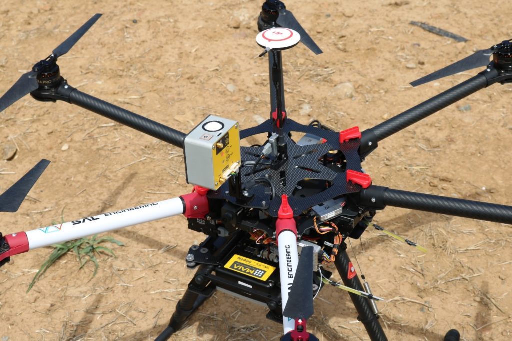
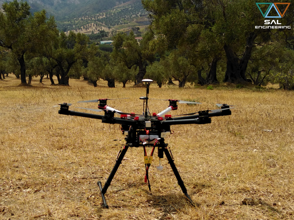
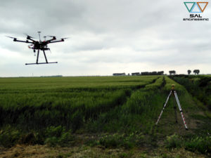
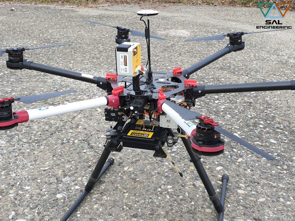
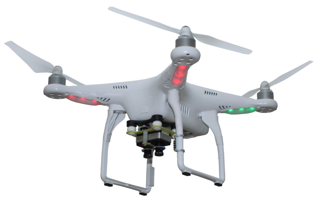
DJI S900 equipped with MAIA

The main variable to consider is not the extension but rather the problem of being able to avoid ever more uniformity of treatment for crops placed on different soils affected by different problems, which can generate non-rational use of fertilizers, pesticides, herbicides. Precision farming is an innovative form of agriculture, driven by the use of techniques and technologies aimed at the implementation of agronomic interventions with varying intensity within the different crops of land, on the basis of the actual need for cultivation and of the chemical, physical and biological properties of the soil. The Guidelines for the Development of Precision farming in Italy represent a vademecum of technical, regulatory and scientific sources and proposals which in addition to defining the principles, methods and technologies, identifies the actions and tools suitable for achieving in 2021 the goal of managing 10% of the cultivated agricultural national area. All information has been ordered to promote business management (agriculture, forestry and zootechnics) with new tools and technologies that make it “the right thing, the right place at the right time”, with the most ambitious goal of introducing simplified site-specific analysis models as a decision support system for the entire business management, optimizing returns in the light of advanced climate environmental and economic sustainability.

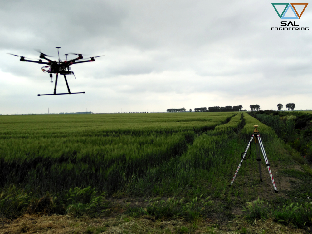
GPS Master and DJI S900 equipped with MAIA

The Italian Government plan, launched in 2015 with the fruitful scientific and economic consultations of EXPO 2015, identifies a company model to which this project is primarily aimed: companies with an average size of 7 hectares. Governments and regions can use EU rural development funds to reach an ambitious goal: get within 5 years to have 10% of the areas cultivated by Precision farming.

Precision farming principles now can be applied to all agronomic operations (soil cultivation, sowing, fertilization, irrigation, crop protection): it’s important to keep in mind that the assumption to apply market solutions is the strategic management of intra-field and inter-field geographic variability, and thus the management of the information obtained from the surveys carried out with new generation sensors. Such a management allow to achieve different advantages:

  • in the agronomic field, by increasing the crop performance

  • in the economical field, through the best use of inputs and the reduction of crop costs

  • in the environmental field, because reduces the use of pesticides, herbicides, fertilizers.

The aim of precision farming is also to manage the variability that exists within the crop by the means of resources and technological solutions to optimize the use of productive factors reduce costs and preserve natural resources. The first step is to know the variability within the field: crop mapping by photogrammetric surveys with multispectral, hyperspectral and thermographic sensors is the most widely used technique for collecting data on variability in crop health conditions and on yield variability, integrated with timely observations conducted by meteorological stations.

The agronomic application of this knowledge, that basically consists in the transformation into agricultural interventions, is through the use of variable-rate agricultural machines equipped with GPS, ISOBUS technology and spraying management software, whereby the grower will act in a manner rational culture, it will always be able to monitor its interventions in the future and improve production in terms of quantity and quality. The application of these techniques involves different intervention and processing costs depending on:

  • type of crop (arable land, orchard, vineyard, fruit and vegetables, etc.)
  • crop extent
  • climate reference conditions
  • technological development framework for the agricultural production process
  • technological development framework for the decisional production process
  • phytosanitary framework that is to be maintained for cultivation

The application of Precision farming technologies makes European agriculture more sustainable and profitable: to say that is a new report by the European Commission’s Joint Research Center (Jrc), named Precision agriculture: an opportunity for EU Farmers – potential support with the CAP 2014-2020. Indeed, recent studies on yield monitoring show that the application of localization technologies and targeted interventions leads to a net savings of 15% to 50% depending on the variables that define, as above, the nature of the farm and its production process. Farming management of this type allows to increase the efficiency of the production system by streamlining the individual interventions. In Italy, the application of Precision farming is very heterogeneous and affects only 1% of the whole agricultural area. At present the most advanced production chain is winery; they follow rice, cereals and zootechnics. The predictions for precision farming in Italy confirm the orientation towards development and its spread will increase rapidly over time, similar to what is happening in other European Union countries.

MAIA WV, MAIA S2 and ILS

MAIA WV, MAIA S2 and ILS

The proper instruments for your multispectral survey

SAL Engineering designs and produces integrated systems for aerophotogrammetric and terrestrial surveys for 3D reconstruction with high accuracy of terrains, farms, buildings, factories, mines, landfills, construction sites, radio towers, bridges, roads and rails infrastructures, historical buildings. A flexible and non-invasive procedure permits a wide range of applications in data acquisition.

SAL Engineering integrated system for multispectral data acquisition with DJI S900, GNSS antenna and module, DJI A2 autopilot, MAIA Multispectral camera and ILS – Incident Light Sensor.

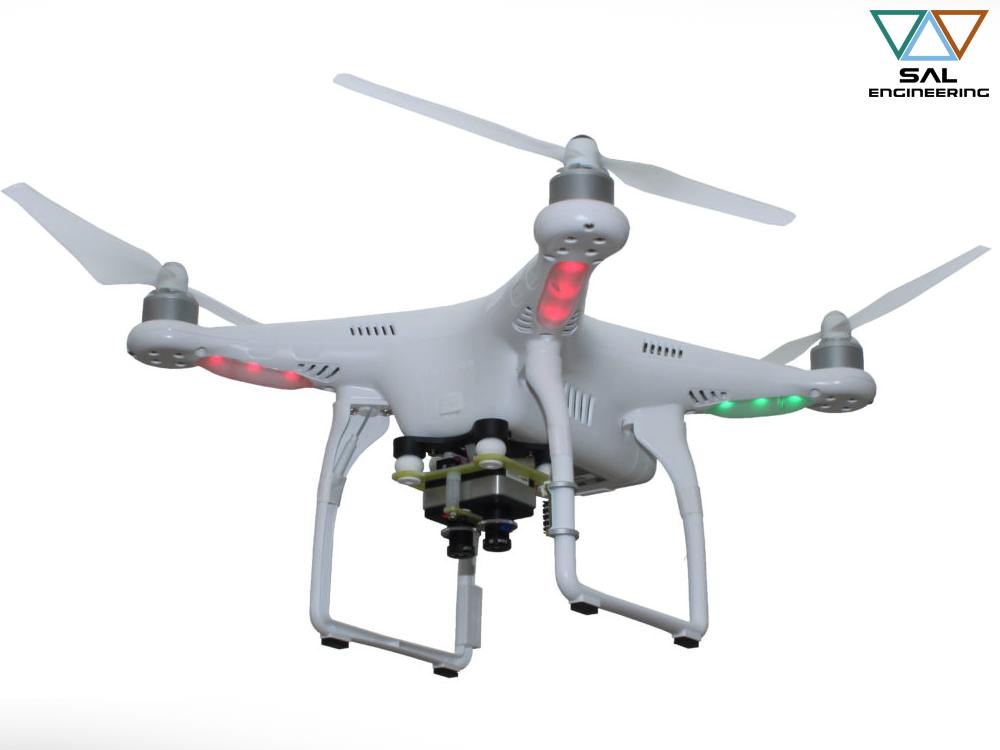
The system is composed by a remotely operated aerial vehicle, a gimbal for stabilized shooting, and the multispectral, thermographic or photogrammetric sensor. The integration of inertial platform and GNSS allows a stabilized and planned flight through waypoints; other GNSS antenna and receiver allow the georeferencing of each photo, for a better and faster 3D reconstruction in Structure from Motion softwares. In fact, multiband frames and GNSS data are elaborated with more developed photogrammetric softwares, that use Sfm and Bundle Adjustment algorithms for the creation of an high density point cloud (with RGB data), with which it is possible to create different products.

The acquisition of georeferenced photos is complementary to a topographic survey on field; different GCPs (Ground Control Point), that are visible on photographs, are measured by GNSS system or Total Station with high accuracy, due to optimize the bundle adjustment process, georeference the 3D model and insert it in a geodetic reference system. If a portion of the area is not suitable for photogrammetric survey, a topographic survey is done and data are lately integrated in the point cloud due to produce a complete model of the entire area.

SAL Engineering presents MAIA, the multispectral camera that provides simultaneous acquisition of high-resolution images at different wavelengths in the visual (VIS) and near infrared (NIR) regions. It is designed to be used onboard remotely piloted aircraft systems or aircraft, as well as having several terrestrial uses.

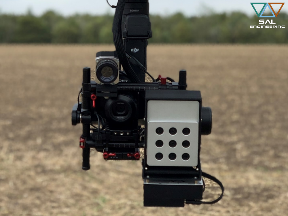
MAIA multispectralcamera and ILS – Incident Light Sensor

MAIA Multispectral Camera is based on an array of nine sensors, each with its relevant band-pass filter that precisely defines the radiation range to be detected. The sensitivity interval of the MAIA WV model is from 390 nm to 950 nm, while the MAIA S2 model has the same wavelenght intervals of Sentinel-2 satellite, and then it goes from 433 nm to 875 nm, which allows the camera to be used for several applications in agricultural, industrial and environmental monitoring. In fact, two filter sets are offered by default, matching the bands of the WorldView-2™ or Sentinel-2™ satellites. Other filters within the sensitivity interval can be supplied on request, depending on the customer needs.

The sensors have 1.2 Mpixel resolution, which generates a total resolution of 10.8 Mpixel per shot, separated into the various bands. The sensors provide excellent performance in terms of their sensitivity, and they operate in global shutter mode. Thus, all of the sensors are exposed simultaneously, with the images acquired without the spatial distortions that are typically related to rolling shutter sensors, even at high flight speeds. The sensors are thus ideal for all applications where high quality and radiometric precision are needed.

ILS – Incident Light Sensor

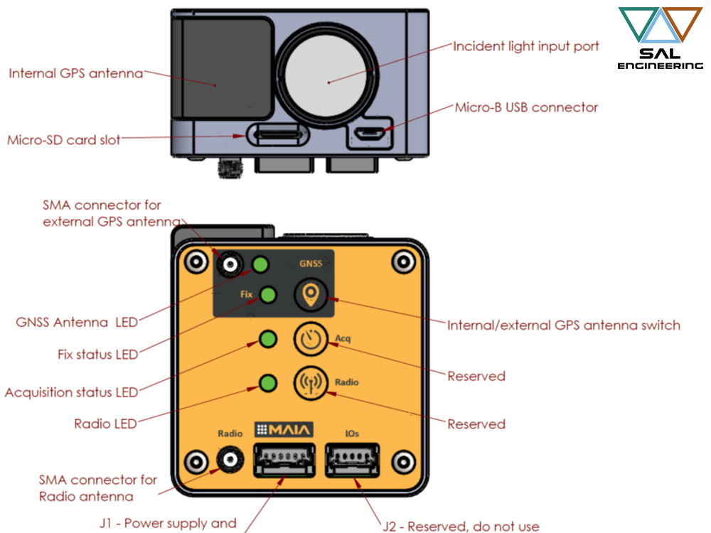
The ILS captures and continuously registers the incident and diffuse light at the time of each single shot, at the same multispectral bandwidth intervals. Radiance data for each single shot in each single band is related to GPS positioning data and ambient conditions data (temperature, humidity, orientation, exposure, and sun position) at the time of acquisition, allowing correct correction of the multispectral data, which is so comparable with satellite data (WorldView-2 or Sentinel-2 data) or multitemporal surveys carried out with the same arrangements. It provides environmental incident light data thanks to a sensor for measuring ambient light and recording the average reflectance, exposure time and environmental data for each shot, which are all useful parameters for the appropriate radiometric correction of the images acquired by MAIA in the 9 bands.

The MAIA Multispectral Camera provides fine regolation of all parameters related to the acquisition of the images, from the exposure time of each sensor, to their exposure frequency. The automatic configurations supplied are suitable for standard use.


MAIA WV and MAIA S2 with ILS, basically the proper instruments for your multispectral survey.